Back to Weather

5-day forecast / Nocatee, FL

ThursdaySlight Chance Showers And Thunderstorms97° / 77° 19%
FridaySunny then Slight Chance Showers And Thunderstorms97° / 79° 17%
SaturdayMostly Sunny then Chance Showers And Thunderstorms97° / 77° 34%
SundayMostly Sunny then Showers And Thunderstorms Likely94° / 75° 64%
MondayChance Showers And Thunderstorms91° / 75° 76%

Heat Advisory in Effect for Nocatee as Feels-Like Temps Hit 105F - Jul 9, 1 PM

Nocatee weather, updated every four hours — local forecasts you can trust.

A Heat Advisory is active for Nocatee, TX, with dangerous heat index values reaching 110 today. Current conditions show oppressive humidity and high temperatures.

Coralie Doyle

July 9, 20262 min read

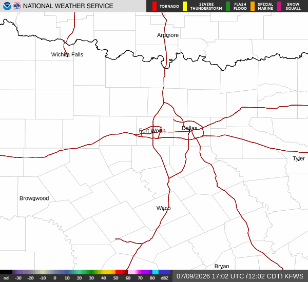
National Weather Service radar for North Texas (KFWS)

*As of Jul 9, 1 PM local time.*

Dangerous Heat Conditions

A Heat Advisory is currently in effect for Nocatee, Texas, signaling dangerous heat conditions for the region. As of this Thursday afternoon, the air temperature stands at 93F, but the combination of heat and humidity makes it feel like 105F. The atmosphere is oppressively humid, with a dew point of 75F and relative humidity at 56%. Winds are blowing from the south at 10 mph, with gusts reaching 12 mph, under a clear sky.

The National Weather Service has issued this advisory due to heat index values that are expected to reach as high as 110 today. Residents are urged to take this threat seriously. The advisory remains in place until the evening, emphasizing the need for caution during the peak heat hours.

Forecast for Today and Tomorrow

Today, temperatures will climb to a high near 97F before falling to around 95F in the afternoon. There is a slight chance of showers and thunderstorms after 5pm, with a 19% chance of precipitation overall. Any rainfall is expected to be minimal, with less than a tenth of an inch possible. Winds will shift to the south at 7 to 10 mph, with gusts as high as 16 mph.

Tonight, conditions will remain partly cloudy with a low near 77F. The chance of showers and thunderstorms persists, particularly before 8pm, with a 30% chance of precipitation. Heat index values will remain elevated, reaching up to 102. Winds will decrease to southwest at 3 to 10 mph.
Tomorrow, the sun will return, bringing a high near 97F and a low near 79F. A slight chance of showers and thunderstorms is possible between 3pm and 5pm, with a 17% chance of precipitation. Heat index values may reach 108. Winds will be southwest at 2 to 13 mph.

Safety Reminders

Given the active Heat Advisory and high heat index values, it is critical to stay hydrated and limit outdoor exertion, especially during the midday and early afternoon hours. Check on neighbors and vulnerable individuals who may be affected by the extreme heat. Ensure that pets and livestock have access to ample shade and fresh water. Avoid prolonged exposure to the sun and seek air-conditioned environments when possible.

National Weather Service radar for North Texas (KFWS)

Sources

https://radar.weather.gov

https://api.weather.gov

https://open-meteo.com

Share

Coralie Doyle

Coralie Doyle covers weather, storms, and seasonal life around Nocatee.

Related Stories

More in Sport